Western Wildlands Route
Admin Jun 17, 2024“The 2,700-mile Western Wildlands Route (WWR, formerly known as the Wild West Route) offers bikepackers a non-technical riding experience through the vast expanses of wild and public lands in the Intermountain West. Nearly 70% of the route is on public lands - 18 National Forests, 6 National Parks and Monuments, and 4 areas with Bureau of Land Management National Conservation Lands designation.”, according to Bikepacking Roots. This route took us 12 days, 8 hours, 40 minutes, and 9 seconds of cycling time to cover 4312 km (2679 miles), including 47660 m (156372.46000000002 ft) elevation gain, with an average speed of 15 km/h (9 mph), reaching a maximum speed of 63 km/h (39 mph) on Saturday, June 1, 2024. During cycling, there was a minimum temperature of 0 °C (32 °F) on Thursday, May 30, 2024, and a maximum temperature of 50 °C (122 °F) on Friday, June 7, 2024.
Continue readingGreat Divide Mountain Bike Route
Admin Sep 12, 2022“The Great Divide Mountain Bike Route (GDMBR) is Adventure Cycling’s premier off-pavement cycling route, crisscrossing the Continental Divide in southern Canada and the U.S. This route is defined by the word “remote”. Its remoteness equates with spectacular terrain and scenery. The entire route is basically dirt road and mountain-pass riding every day. In total, it has over 200,000 feet of elevation gain. Nearly 2,100 miles of the route is composed of County, Forest Service, Bureau of Land Management (BLM), and Canadian provincial unpaved roads.”, according to the Adventure Cycling Association.
Continue readingLatest posts
Day 20: Difficult roads and another detour
EvE May 28, 2024Today we rode from our dispersed campsite east of Strawberry Reservoir to Cottonwood Campground in the Rockport State Park. We had lots of sunshine, but also some threatening clouds. Road surfaces were difficult double-track, pavement, gravel, and a path used by wildlife. Riding statistics: on Tuesday, May 28, 2024, day 28 on the route, it took 12:01h (08:03h moving time), between 6:39 and 6:40, to cover 122.32888 km (76 miles), including 1709 m (5607 ft) elevation gain, with an average speed of 14.0 km/h (8.7 mph), while reaching a maximum speed of 59 km/h (36.7 mph). During this ride the average temperature was 25 °C (77 °F) with a minimum of 3 °C (37 °F) and a maximum of 42 °C (108 °F).
Continue reading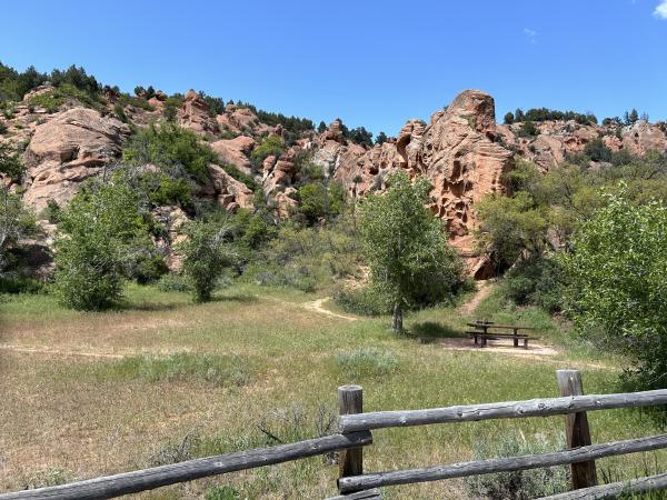
Day 19: Meeting Anna and John
EvE May 27, 2024Today we rode from the campground in the Palisade State Park to a dispersed campsite 15km east of Strawberry Reservoir. We had blue skies with a few clouds all day. We mostly rode a paved road, and a short difficult single-track. Riding statistics: on Monday, May 27, 2024, day 27 on the route, it took 12:01h (08:03h moving time), between 6:39 and 6:40, to cover 140.42627 km (87 miles), including 1165 m (3822 ft) elevation gain, with an average speed of 17.0 km/h (10.6 mph), while reaching a maximum speed of 51 km/h (31.7 mph). During this ride the average temperature was 27 °C (81 °F) with a minimum of 8 °C (46 °F) and a maximum of 47 °C (117 °F).
Continue reading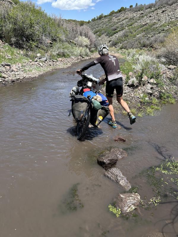
Day 18: A beautiful valley
EvE May 26, 2024Today we rode from the RV Park in Antimony to a campground in the Palisade State Park. We had blue skies with some clouds all day. We started on pavement, at noon back on off road surfaces, and in the late afternoon we did some more on pavement. Riding statistics: on Sunday, May 26, 2024, day 26 on the route, it took 12:06h (08:45h moving time), between 7:04 and 7:11, to cover 150.28266 km (93 miles), including 871 m (2858 ft) elevation gain, with an average speed of 17.0 km/h (10.6 mph), while reaching a maximum speed of 43 km/h (26.7 mph). During this ride the average temperature was 23 °C (73 °F) with a minimum of 2 °C (36 °F) and a maximum of 36 °C (97 °F).
Continue reading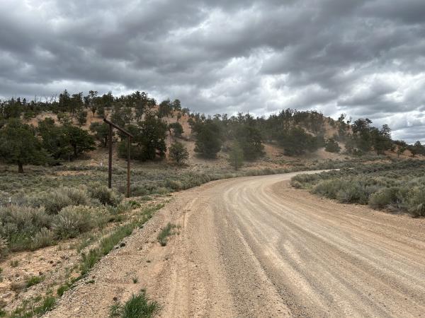
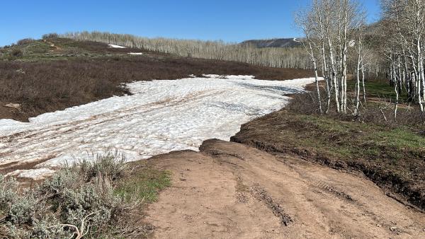
Day 17: Detour because of the snow
EvE May 25, 2024Today we rode from a dispersed campsite close to Bryce Canyon National Park to a dispersed campsite on the Aquarius Plateau. Oh no, we did not make that. We ended the day at an RV Park in a small community. The weather started great with blue skies. In the afternoon that changed to clouded, and then rain. We were supposed to have a gravel and double-track all day, but eventually the afternoon was paved.
Continue reading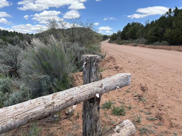
Day 16: Memorial Day Friday, few camp spots
EvE May 24, 2024Today we rode from Kanab to a dispersed campsite 10km before Bryce Canyon National Park. We started the day with blue skies, in the afternoon there were clouds, no sun, but the sun returned in the late afternoon. The first 40km was on a paved road. The rest of the day on a gravel road (with sometimes a layer of 1 to 5cm of really fine grained sand. Riding statistics: on Friday, May 24, 2024, day 24 on the route, it took 10:24h (08:03h moving time), between 7:07 and 5:31, to cover 100.11641 km (62 miles), including 1514 m (4967 ft) elevation gain, with an average speed of 12.0 km/h (7.5 mph), while reaching a maximum speed of 44 km/h (27.3 mph). During this ride the average temperature was 24 °C (75 °F) with a minimum of 15 °C (59 °F) and a maximum of 38 °C (100 °F).
Continue reading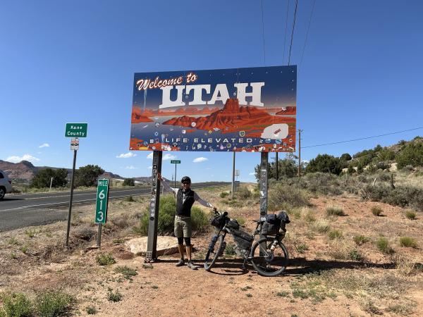
Day 15: Entering Utah
EvE May 23, 2024Today we rode from our dispersed campsite near the Vermillion Cliffs to a motel in Kanab. We had blue skies all day, and the damn wind again. The road was paved for the first 10km, follow by gravel, good and bad, and the last 20km was also paved. Riding statistics: on Thursday, May 23, 2024, day 23 on the route, it took 12:17h (07:41h moving time), between 5:56 and 6:14, to cover 102.68534 km (63 miles), including 1094 m (3589 ft) elevation gain, with an average speed of 13.0 km/h (8.1 mph), while reaching a maximum speed of 39 km/h (24.2 mph). During this ride the average temperature was 27 °C (81 °F) with a minimum of 13 °C (55 °F) and a maximum of 35 °C (95 °F).
Continue reading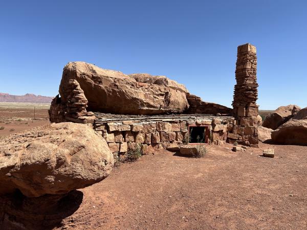
Day 14: More Red Rocks
EvE May 22, 2024Today we rode from the dispersed campsite on the Navajo territory to another dispersed campsite near the Vermillion Cliffs. We had blue skies all day, and wind. The road surface was in the morning good gravel, mainly double-track. In the afternoon we had a paved road along the Vermillion Cliffs. Riding statistics: on Wednesday, May 22, 2024, day 22 on the route, it took 12:17h (07:41h moving time), between 5:56 and 6:14, to cover 126.44569 km (78 miles), including 1167 m (3829 ft) elevation gain, with an average speed of 15.0 km/h (9.3 mph), while reaching a maximum speed of 54 km/h (33.6 mph). During this ride the average temperature was 26 °C (79 °F) with a minimum of 6 °C (43 °F) and a maximum of 39 °C (102 °F).
Continue readingAbout
This is my personal blog on which I keep family and friends updated about my bikepacking adventures.